William Fisher
Map 10
The following land grant was located on an order of Sir Thomas Brisbane on 12th November 1825.......
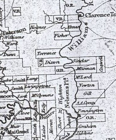
Fifteen hundred acres, county of Durham, parish of Uffington, commencing at the north east corner, and bound on the north by a west line by compass of 220 chains; on the west by a south line by compass of 80 chains; on the south line by compass of 143 chains to William's River, and on the east by William's River to the south west corner of Reynold's farm, and by the west boundary of that farm to the north east corner aforesaid. This land was located on an order of Sir Thomas Brisbane dated 12 November 1825 in favour of William Fisher.
Notes and Links
1). Map showing area between Hunter and William's Rivers, N.S.W [cartographic material]. 1830 - 1899. MAP F 436/E -National Library of Australia↑